All tour information is user generated and although we try our best, we cannot guarantee its correctness. Always consult people with knowledge about the area and get a proper map. If in doubt, hire a guide!
Hakuba Avalanche-slope
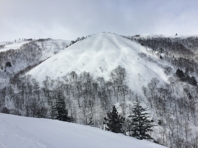
Easy access, with possible avalanche danger but a good wide slope for skiing. Small ridges on the open area adds some fun to the ride.
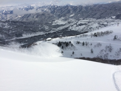
From the transport slope, make your way past the avalanche signs out onto the large open area. There are several routes down, either stay in the middle right and head for the transport slope directly accross on the other side of the valley (this is the route marked on the map). There is also an option to go more to skiers left, you get a bit longer skiing with some nice wooded areas. Pass over the valley before the damm and then traverse east to get back to the slopes to get back to the slopes.
The closest ski resort is Selwyn Snowfields
,
8134 km away.
- Created by: Robert Johansson
- Difficulty: S3 - Medium (<35°)
- Danger/Exposure: E1 - Low
- Time: 00:30 hours
- Total climb: 0 m
- Total elevation drop: 296 m
- Length: 1.01 km
- Highest altitude: 1492 m
- Lowest altitude: 1196 m
- Slope facing: E
- Extra gear: None
- Lift access: Yes
Photos

The run seen from the other side of the valley.

Map
Public runs
No public runs yet.Elevation
Loading...
Slope
Loading...
Negative slope values means the track is heading uphill.
